The ISES Project subsidence monitoring of the catchment basin south of the Venice Lagoon (Italy)

L. Tosi, L. Carbognin
Istituto per lo Studio della Dinamica delle Grandi Masse, CNR, Venezia, Italy

P. Teatini
Dept. Mathematical Methods and Models for Scientific Applications, University of Padova, Padova, Italy

R. Rosselli
Consorzio Venezia Nuova – Servizio Informativo, Venezia, Italy

G. Gasparetto Stori
Consorzio di Bonifica Adige Bacchiglione, Padova, Italy


ABSTRACT

The catchment located south of the Venice Lagoon experienced during the last century a general land settlement owing to groundwater pumping, oxidation of organically rich soils enhanced by agricultural activities, and natural sediment compaction. High land subsidence rates (2-4 cm/year) have been estimated in the area comprised between the lagoon edge and the Adige River and located between two leveling lines of the Italian national network (IGM lines n. 7 and n. 19). Only a partial knowledge on the behavior of land elevation is available in this region. To overcome this lack of information, a new fine leveling and GPS network has been established in the area within the ISES Project funded by National/Local water and administrative Authorities. The first field measurement carried out in 1999 have produced as a major result an accurate knowledge of the geoid height in this part of the Po River plain and has pointed out the stability of the area located along the lagoon boundaries during the six-year period from 1993 to now.


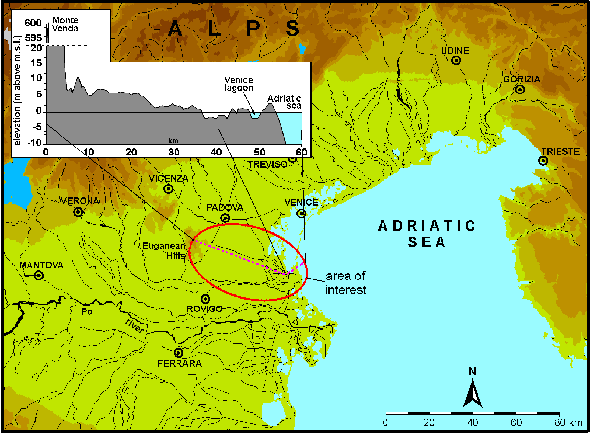
Location of the area of interest in the Eastern Po plain with a vertical cross section showing the elevation above the mean sea level.


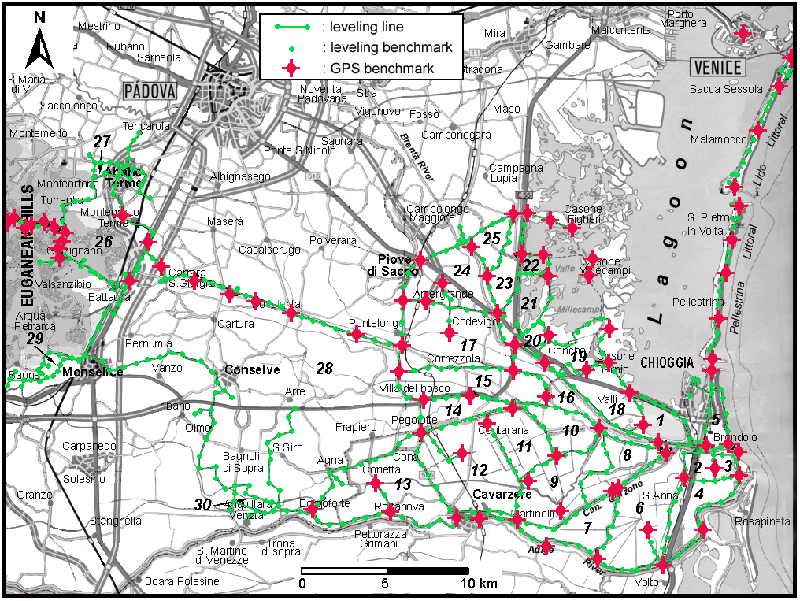
The ISES leveling network and GPS benchmarks.

Back